Brochures
Prevent Infrastructure Failures with EarthWorks
June 29, 2022

EarthWorks offers a proactive approach to infrastructure management by monitoring subsurface soil moisture across diverse installations. Using satellite-based technology and advanced algorithms, EarthWorks detects high-moisture areas without ground damage, enabling timely preventive measures. Seamlessly integrate with EO Discover for actionable insights and efficient resource prioritization, ensuring the future security of your infrastructure.
Download
EO data has a crucial role to play in our ability to monitor infrastructure, subsurface soil moisture, and other critical...
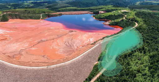
EarthWorks empowers mine operators with advanced monitoring of subsurface soil moisture, detecting potential risks before they pose threats to lives...

EarthWorks offers a proactive approach to infrastructure management by monitoring subsurface soil moisture across diverse installations. Using satellite-based technology and...