ASTERRA provides a number of industries with intelligence and insights from beneath the surface of their largest installations. Without breaking ground, ASTERRA uses patented algorithms and artificial intelligence to detect leaks, assess pipes, explore minerals, and locate moisture near major installations.
ASTERRA is the first technology capable of monitoring soil characteristics such as underground moisture and trace minerals over immense areas quickly, easily, continually. This is our expertise:
PolSAR, or polarimetric synthetic aperture radar, carried on a wavelength that can provide subsurface data on soil characteristics.
We gather data from low Earth orbit satellite systems. We revisit the same regions every few days or weeks as needed to monitor vast expanses.
A series of patented image & signal processing algorithms and AI models translate the raw data into visualizations of the location and concentration of soil phenomena.
ASTERRA geospatial technology has global implications for industry, safety, sustainability, and the environment.
Learn which ASTERRA solutions best serve your needs.
ASTERRA geospatial technology has global implications for industry, safety, sustainability, and the environment.
Learn which ASTERRA solutions best serve your needs.
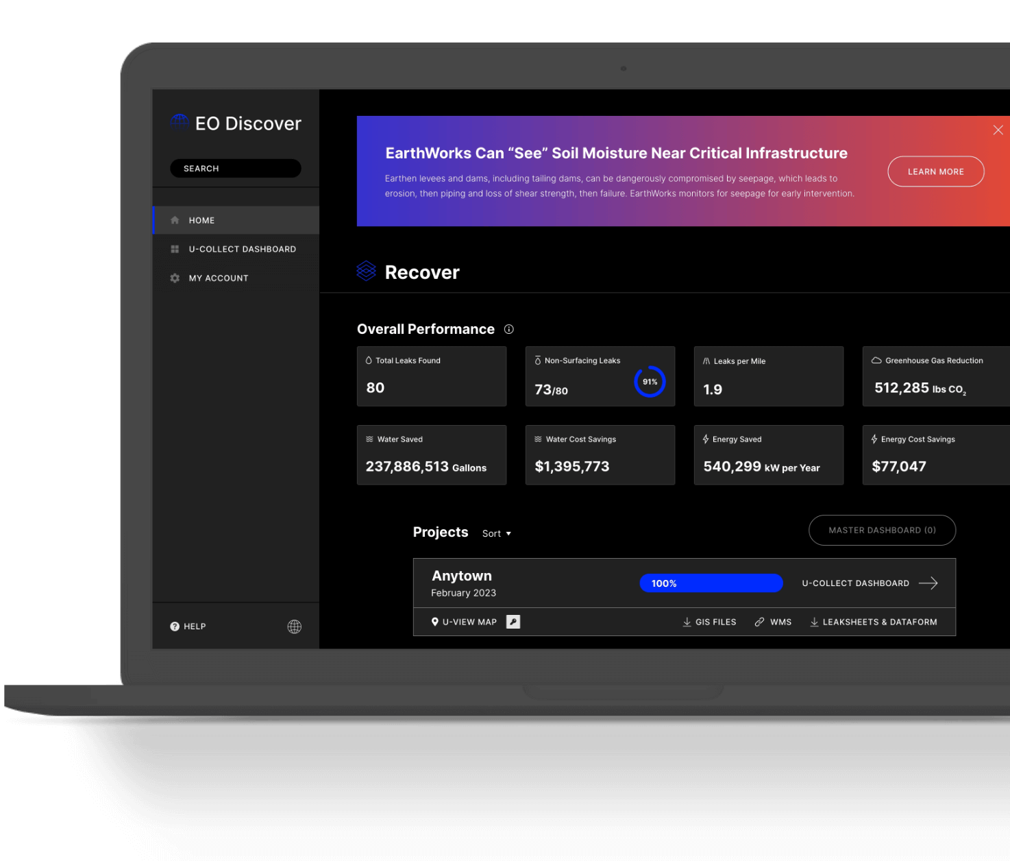
EO Discover is the repository for all insights from your ASTERRA projects. Find leak locations, crew activities and repair progress, savings on water, money, energy, and CO2 emissions, and other key data conveniently centralized on EO Discover.
See EO DiscoverThe ability to know what’s going on beneath the surface of the Earth offers infinite possibilities to understand the planet and protect what we have built.
The ability to see and respond to at-risk situations quickly can have a major impact on the world’s most pressing environmental, economic, and sustainability concerns.
ASTERRA’s expertise in PolSAR, artificial intelligence (AI) and data science, remote sensing, and geomorphology continues to extend our technical capabilities.
After succeeding in reducing leaks and water loss for the water industry, we now assess dams and levees, rail, roads, mining, large-scale properties, and will soon be predicting mineral presence.
We work with partners whose technology, mission, and values complement our own. We are actively seeking new partners to provide total customer solutions and expand into new verticals.
Mission
ASTERRA will become humanity’s eyes, guiding it through Earth’s changes by applying advanced analytic capabilities to synthetic aperture radar.
About Asterra