Blogs
Learning from Dam Failures: Analyzing 5 Instructive Examples and Their Lessons
June 28, 2023
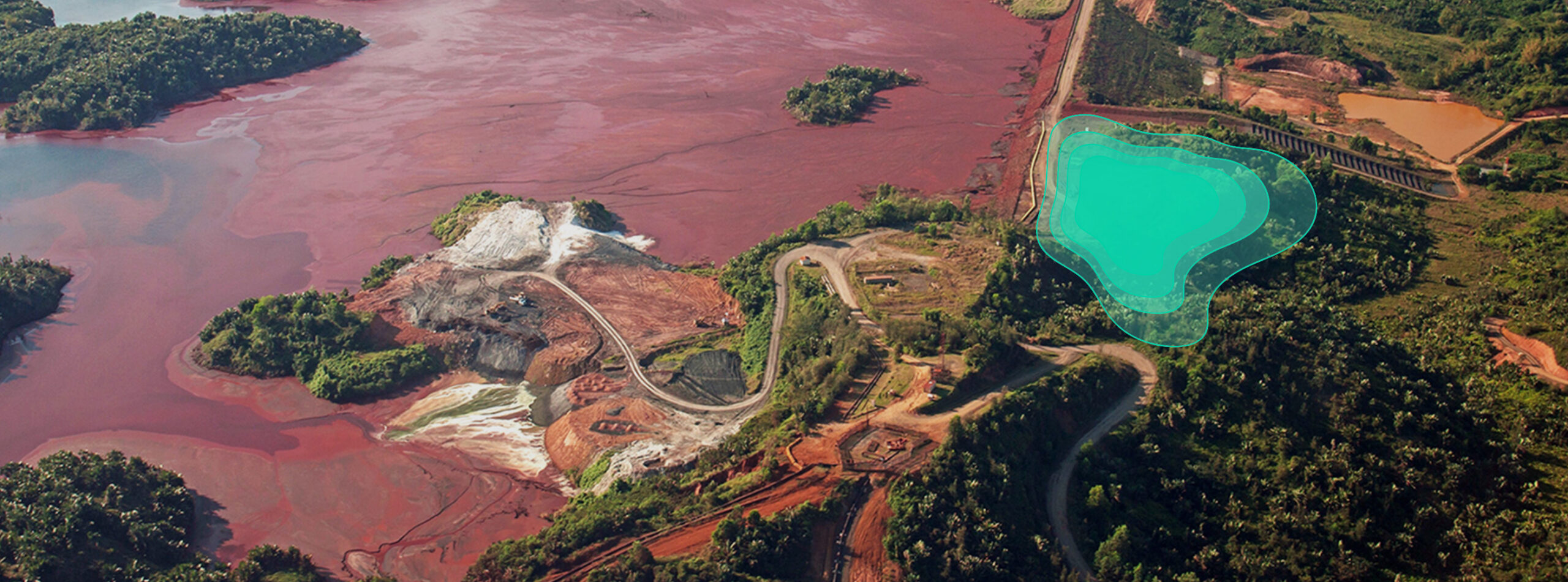

For as long as humankind has been building dams, dam failures have been an issue. In Eqypt in 2,600 BCE, while still under construction, a 14 m tall dam was destroyed by one of the floods it was being built to control. In the 500s, the Marib Dam in Yemen failed yet again, displacing 50,000 people and upending a society.
Under international law, dams are considered “installations containing dangerous forces”, and are one of the most disruptive forms of infrastructure failure. When collapse threatened the very full Oroville Dam in California in 2017, it was holding back 3.5 million acre-feet of water, 4.3 billion cubic meters, and more than 180,000 people were evacuated. Luck and quick action saved the dam and thousands of lives that year, but it isn’t always so. In 1975, the Banqiao Dam in China collapsed, and an estimated 171,000 lives were lost, the worst dam failure in history.
Dams fail for a variety of at-the-time reasons. Water may “overtop” the dam, eroding it away as it gathers force pouring down. Seepage, if not found and remedied, will destroy dams “gradually, then suddenly” through erosion and then ‘piping’ of the supporting soil. When a whirlpool appears, the end is near. When the soil in a dam can’t drain, ‘static liquefaction’ will cause the dam materials to simply lose their strength. Severe storms have destroyed dams. So have poor decisions in siting, materials, or construction. “Sequential raising” (making it taller every time it starts to get full) and poor maintenance also cause dams to collapse.
Regardless of the technical reason a dam fails, there’s always a bigger story behind it. These stories of some of humanity’s most notable dam disasters all offer lessons for today.
South Fork Dam was an earth- and rock-filled dam a few miles from Johnstown, “just above it,” in some tellings. It failed in the spring of 1889, on May 31, a Friday. The 20 million tons of water that roared out of it took 2,209 lives. Property damage was approximately $17 million.
The immediate cause was overtopping, a few days after an unusually strong storm hit the area. The real cause, however, was the arrogance of some of the era’s wealthiest amateur engineers, who had built South Fork Dam on the remains of a previously failed dam. They were members of the very exclusive South Fork Hunting and Fishing Club and had names like Carnegie, Mellon, and Frick.
Looking to create a nicer place to fish, Pittsburgh businessman Benjamin Ruff bought a lake that had a ruptured dam already in place. To rebuild the dam and create their ideal fishing spot, Ruff and his colleagues initiated a series of disastrous, sometimes on-the-fly, engineering decisions. First, they lowered the dam crest by three feet so the top would be wide enough (Ruff claimed one foot) for their carriages to cross. That decision reduced the height of the freeboard, which is the amount of dam above the water line. They never repaired the low-level outlet conduits from the failed dam to properly release water. To keep the fish from going through the spillway when the water was high, they built a mesh across it. Finally, the materials they used in the embankment settled and made a low point in the crest. Overtopping was just a matter of time. The official cause was listed as an Act of God. But with dams, it almost never is. When the storm hit South Fork Dam, the fish mesh worked; it clogged the spillway with fish, and the dam overtopped. The real cause was too much water, not enough engineering, and not enough dam.
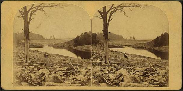
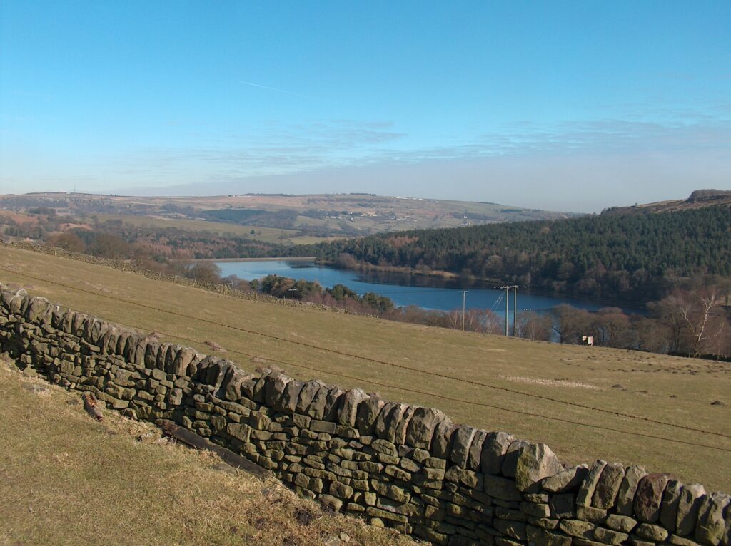
The failure of the Dale Dyke Reservoir on March 11, 1864, is better known by the tragedy it caused, the Great Sheffield Flood. Sheffield Waterworks Company was building the Dale Dyke Dam to create a reliable water source for the growing village of Bradford. It had an earthen embankment and a clay core. (Clay is used for its resistance to seepage.) The dam was completed by April 1864. On March 10 of 1864, it was finally full. It failed the next day, killing 244 people.
Shortly before the dam failed, an engineer noticed a sliver of a crack across 50 yards of the embankment. More engineers were called to inspect the crack, now grown a bit wider. Sensing no immediate danger, they let some water out and continued the inspections of the now hand-size slit across the dam. When water started flowing down the embankment, they tried gunpowder at the base to let some water out, but it would not ignite. At about midnight, the dam gave way and some 3 million cubic meters of water descended through the Loxley Valley. No one had been warned.
The cause of the failure is disputed. The builders denied blame and suggested it was a slippage of the land underneath the dam. Others accused the company of inadequate or faulty construction. The official inquiry opted for land slippage, absolving the company and saving several reputations, but not setting the issue for history.
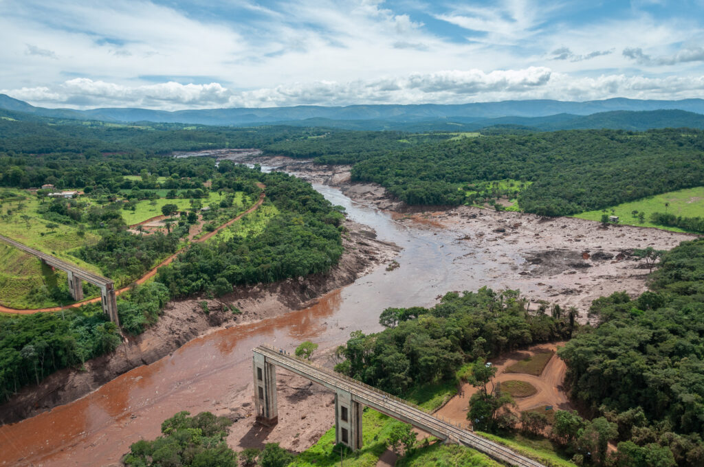
Brumadinho is a municipality in the Brazilian state of Minas Gerais, in the country’s mineral-rich southwest. In 2019, “Dam I” at an iron ore mine about five miles outside the city collapsed to due static liquefaction.
Dam I was a tailings dam that stores mine waste, often a toxic slurry of dirt, water, and rocks, with metal and chemicals mixed in. With no place else to go, tailings are expediently stored in earthen retaining structures called tailings dams situated near the mine. The dams themselves may be constructed from tailings, just as Dam 1 was.
When Dam I failed, 12 million cubic meters (3.2 billion gallons) of tailings rushed through a nearby valley for 10 brutal kilometers (6.2 miles). The official death toll was 270, including 11 people who have yet to be recovered. Agriculture suffered. Pollution from the collapse reached water supplies in 21 municipalities up to 120 km (75 miles) from the collapse site. It cost the dam’s operators $7 billion to settle the claims.
The dam failed with no warning, just a few seconds from visible signs to total collapse. Drone inspection flights just seven days earlier found no problems. The instruments installed on the dam did not show any deformation.
According to the engineering report, the dam was constructed over a period of 37 years, sequentially raising its height ten times during that period. The tailings the dam was built of became stiff and brittle over time. The initial design lacked sufficient internal drainage and had a very steep upstream slope. Ponded water was allowed to get too close to the top of the dam crest. After an intense rainy season, the dam was too brittle, too steep, and built of materials that didn’t hold up. The structure lost its strength and the dam collapsed.
The Malpasset Dam was an exquisite-looking concrete arch dam that curved upstream into the flow of the Reyran River in the French Riveria. It was designed by André Coyne, a president of the International Commission on Large Dams.
The dam was 218 feet high with a 736-foot-long crest and a notched spillway in the center. Its slender width of 22.2 feet, the thinnest arched dam of its height, made for an elegant appearance. Mr. Coyne was one of his era’s leading experts on concrete arch dams. Yet like the Dale Dyke Reservoir before it, the Malpasset Dam failed just as it was filled for the very first time. On December 2, 1959, five years after it first began to fill, Malpasset collapsed and killed 421 people. Damage was estimated at $68 million.
In a sense, the Malpasset Dam didn’t fail, the ground beneath it let it down. The site of a dam is the most consequential decision its builders will make. The ground beneath it and the surrounding walls have to be stable enough to handle the stress. Igneous and metamorphic rocks are ideal, strong enough for the weight and impervious to water. But in the case of Malpasset, not impervious enough.
After the dam failed, faults and cracks were discovered in the rock behind the left abutment. Clay-filled seams compressed and allowed the abutment to shift. The movement and loss of support underneath caused the dam to crack and collapse.
The movement of the ground under the Malpassat is not disputed, as in Dale Dyke. But the investigations at the time felt that the geology under the dam was not adequately studied and accounted for.
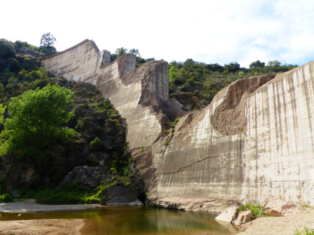
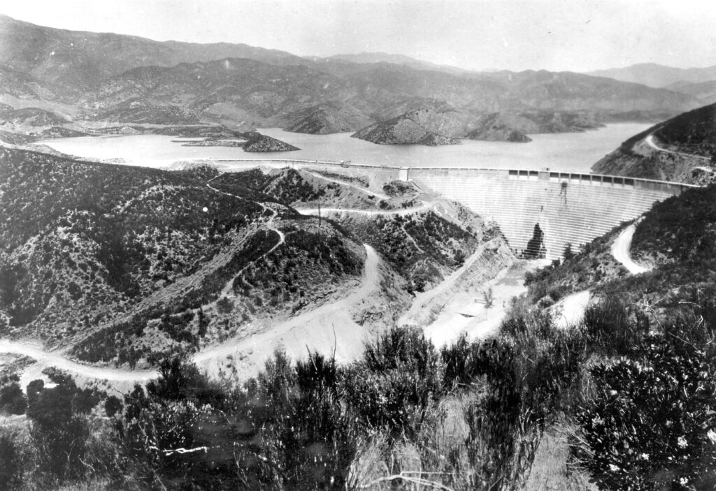
The St. Francis Dam was a concrete gravity dam, in which the horizontal force of the water is held back by the weight and shape of unreinforced concrete blocks. The Hoover and Grand Coulee are concrete gravity dams, as is the enormous Three Gorges Dam in China. The ideal location would be a stiff rock foundation that can bear the stress of a full dam.
The St. Francis Dam opened in 1926, designed by William Mulholland, Chief Engineer of the Los Angeles Bureau of Waterworks & Supply. He established his reputation with the planning and construction of the 419-mile-long Los Angeles-Owens River Aqueduct. Mulholland had also worked on several earthen embankment dams.
Just before St. Francis, Mulholland was involved in the planning of the Mulholland Dam concrete gravity dam on the Hollywood Reservoir, just above Los Angeles. Simply transferring those plans to the St. Francis location 40 miles north without investigating the site adequately would be the first of several mistakes. Changing the height of the dam twice during construction, adding ten feet each time — without making the base any wider because of the additional time and money — would be another. So was the failure to seek independent review.
Over the course of the dam’s short life, any number of fractures due to “contraction” were found and repaired. Leaks were regularly found and fixed. In the days before the collapse, the dam was close to topping. On the day of the collapse, a fairly vigorous leak of 2-3 cubic feet per second was found near the base. Mulholland and another engineer were concerned and felt corrective action was warranted at some point in the future. The dam collapsed about 12 hours later.
The St. Francis dam failed a few minutes before midnight on March 12, 1928, two years after it opened, unleashing an initial flood wave 140’ high. More than 430 people died in the disaster, and power was cut to much of Los Angeles. The financial toll has been estimated at $7 million. Mulholland took full responsibility and chose to end his career. Within a few years, a decision was made to reinforce the Mulholland Dam and reduce its maximum storage.
Just as with Malpassat, the location proved fatal. The material on the left side of the dam did not have the strength, especially when wet, the support a dam. A number of investigations were undertaken that pointed to structural failure on the west side of the dam, made inevitable by the ground it was built on.
The United States Bureau of Reclamation has devised a methodology for calculating the cost of dam failures that considers three main impacts.
One of the most direct impacts is the loss of the dam’s benefits, such as the loss of power when St. Francis collapsed. Industry and agriculture may lose access to water, which affects production. Recreation is also affected. Damage to downstream property is also a direct impact. Imagine the mass destruction throughout the Sacramento region that would have occurred had Oroville actually failed. And the cost of repair or replacement, including the properties on-site, can be significant.
According to the Association of State Dam Safety Officials (ASDSO), “From January 2010 to April 2020, states have reported 270 dam failures and 581 ‘incidents’ – episodes where dams could have failed without intervention or if circumstances had not abated. Dam and downstream repair costs resulting from failures in 23 states reporting in one recent year totaled $54.3 million.”
By the time a dam failure mode becomes noticeable, the window of opportunity for taking preventive measures is already narrow. In some of the cases cited above, time from awareness to failure was a matter of hours, minutes, or seconds. The ASDSO recommends five steps for preventing failures:
Preparation: Put an action plan in place for various failure modes long before any warning signs appear. Know in advance where machines, materials, and personnel are coming from if a dam needs to be shored up on short notice. Understand the possible failure modes, and have a water management or engineering plan in place for each. (In the Hollywood Dam, they used both: reducing volume and strengthening the structure before any problems appeared.)
Assessment: If warning signs do appear, assess the potential failure mode, its progress, and threats to public safety. A chain of command should be established, and interests downstream must be informed.
Dam Monitoring: Dams should be continually monitored, but in more emergent situations, a protocol for monitoring the progress of a deficiency should be established so that if something needs to be done, people know.
Response: In responding, public safety is the number one concern. As the crisis at the Oroville Dam became clear, operators started releasing water down the spillway, but the force of the water started tearing the spillway apart. Hundreds of thousands of people were evacuated in case the next engineering solutions failed.
Post-Action Documentation and Follow-Up: Thoroughly documenting a situation provides essential learning to prevent future dam failures. The final reports should be distributed to all relevant parties.
Ongoing dam monitoring is an essential aspect of dam safety, but there are challenges. Many of the techniques used to monitor dams are limited in their range, effectiveness, or both. Traditional ground penetrating radar can be used but is less effective on dynamic structures like tailings dams than on solid structures. Laser scanners have been used to detect movements in a dam wall, but the hardware investment is prohibitive and the technology works best only in specific situations.
Drones and ground sensors were used to monitor the Brumadinho Dam, but a week before it failed found nothing. Seismic sensors have their own limitations. Satellite radar, such as InSAR, shows movement, but not the underlying cause.
ASTERRA EarthWorks is the first satellite-based failure prevention technology capable of monitoring underground soil moisture over immense areas, including large dams, quickly, easily, and continually. EarthWorks deploys synthetic aperture radar (SAR) from orbiting satellites. Using the L-band on the electromagnetic spectrum, it penetrates the ground to about 3 meters, where it will see moisture in the soil that can indicate seepage from a dam. EarthWorks can re-image the same area several times a month to note any changes in moisture conditions so that preventive action can be taken.
Learn more about preventing dam failures. Explore ASTERRA’s satellite imaging technology to visualize the moisture surrounding dams and levees and take the actions that are needed to protect lives and property today.