Blogs
Levee vs Dam Technology: What are the Differences?
November 18, 2022

Dams and levees each play a major role in making vast areas of the country habitable and safe by controlling water. Flood control, water storage, power generation, irrigation, waste containment, and other needs are all fulfilled by these large and complex infrastructure assets. It’s not generally thought about, but many dams and levees are categorized as “earthworks,” meaning, literally, they are built of earthen materials, dirt, and rocks that were moved into place, not steel and poured concrete. With the average age of the nation’s levees being 50 years and dams 61 years, their condition and maintenance is a critical and ongoing concern, not to mention a significant engineering challenge. But what are the differences between levees vs dams?
A dam is “an artificial barrier that has the ability to impound water, wastewater, or any liquid-borne material, for the purpose of storage or control…”
There are approximately 92,000 dams in the US, 73,000 of which are earthen dams. The U.S. Army Corps of Engineers has classified some 14,000 dams as “high-hazard structures.”
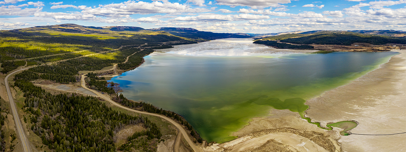
Dams serve a number of uses; many serve several. For example, Nevada’s Lake Mead is the nation’s largest reservoir, created by building the ‘concrete arch’ Boulder Dam, now the Hoover Dam, across the Colorado River. It supplies water to Arizona, California, and Nevada, in addition to hydroelectric power. About 3% of US dams generate hydroelectric power. (Unfortunately, both functions of Lake Mead are under threat due to rapidly dropping lake levels during the current prolonged Western drought, exacerbated by climate change, during a time of growing populations and greater demands.)
“Tailings dams” are a particularly problematic dam category. Tailings are the waste, often a toxic slurry, left over from the mining process. Tailings dams are earthen, sometimes even made of tailings. The storage is permanent, yet the structures are not and have been the site of numerous deadly catastrophes.
A levee is “a natural or manmade earthen barrier along the edge of a stream, river, or lake to prevent the flow of water out of its channel.”
The National Levee Database has logged about 30,000 miles of levees, with an additional 10,000 levee miles outside their portfolio. Approximately 97% of US levees are earthen embankments.
Many people are unaware of the role that levees play. For instance, the 1,600-mile levee system in Northern California, constructed over the last 150 years, provides protection from the devastating floods that regularly ravaged the region. There are nearly 9,000 levee systems in the US performing similar functions.
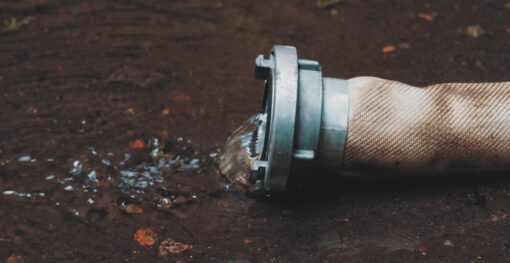
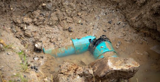
Dams and levees made of earthen materials tend to seep, with water slowly permeating the structure. Unseen and uncontrolled, seepage can dangerously weaken dams and levees. If the quantity and velocity erode enough soil from the embankment or foundation over time before it’s noticed, failure can appear quite suddenly. To prevent such failures, consistent soil moisture monitoring around the structures is essential.
Many traditional techniques for levee and dam inspection, and subsurface soil moisture monitoring around them, are limited in range or effectiveness. Inspection may include ground penetrating radar, which is less effective on earthen structures; and laser scanners, which are expensive and also application-limited. Seismic sensors and InSAR offer help, but also have significant limiting factors.
Monitoring for soil moisture consistently and over large areas is impractical with traditional technologies.
For levee inspection, the Army Corps of Engineers recommends “routine” visual inspections and periodic (every five years) inspections that include standard operations data plus field inspections. These methods are important but don’t give a clear or extensive picture of the underground soil moisture situation. Dam inspection likewise relies on visual inspection and historical data, and lacks detailed assessments of soil moisture due to seepage.
A recent and potentially game-changing advance in remote sensing technology is giving operators, managers, and engineers new insights into soil moisture near dams and levees.
The technology, pioneered by ASTERRA and marketed under the name EarthWorks, uses synthetic aperture radar from several orbiting satellites to create soil moisture maps for vast areas. The largest dams and entire levee systems can be assessed efficiently and quickly in a manner previously impossible.
EarthWorks uses proprietary algorithms to process the satellite data and create the soil moisture map of the area surrounding the earthen structure. Crews can then be directed to specific areas indicated on the map for deeper inspections and mitigation of problems prior to failure.
It’s been clear for some time that visual inspections and “periodic” deeper inspections of levees and dams will no longer be sufficient to safeguard communities that live in their shadows. Structures are not only aging, climate change is intensifying extreme weather events, stressing them beyond what their designers intended. All the while, populations in the downstream hazard areas continue to grow.
Fortunately, the technology now exists for ongoing monitoring of underground soil moisture near these structures. The value of the information is in improving resiliency and safeguarding populations by seeing problem areas quickly — over an entire system — so they can be addressed before they become disasters.
Municipal water systems across the globe face an invisible crisis that drains billions from public coffers annually. Water losses from...
Water security represents one of the most pressing challenges of the 21st century, with global water demand projected to increase...
Urban infrastructure systems are the backbone of modern society, enabling clean water distribution, waste removal, and the overall health and...