Blogs
ASTERRA Finds Sneaky Infrastructure Failures and Leaks Hiding in the Marshes
June 5, 2023


When it comes to tricky topography and ecosystems, using satellite leak detection solutions makes all the difference. This includes tidal flats, coastal wetlands, and marshes. Infrastructure failures and leaks in these areas can be elusive and tricky, but the eyes of PolSAR radar and ASTERRA solutions can see underneath the Earth’s surface, revealing more—at least three times more—than the human eye.
When we think about what may hide in coastal wetlands or marshy areas of land, we do not often think of pipelines and the possibility of leaks of treated water. Instead, we think about oystercatchers, alligators, mussels, fossilized shells, and even artifacts left behind by earlier settlers. In these ecosystems, water flows in and out with the tides or with rainfall, and the marsh or the coastal plain changes consistently, often dramatically.
A marsh is a type of wetland where water covers land, that is not typically forested, for long periods of time. Water flows into the marsh either from rain or a body of water, like a lake, stream or ocean. In coastal marsh terrain, the water is salt water, and sometimes brackish, and is rich in biodiversity. In South Carolina, the Department of Natural Resources estimates there are 344,500 acres of salt marshes, the most of any state. The tides from the Atlantic Ocean drive rapid changes to the depth of water in the marshes and forests, sometimes only covered by water for a few hours a day.
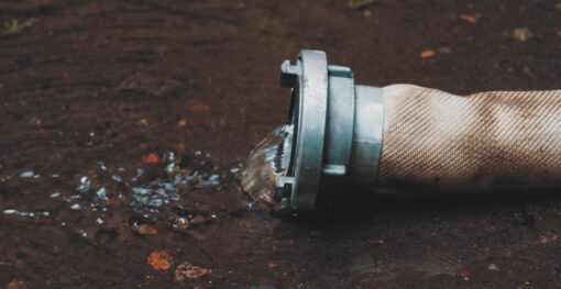
Since water is not always present naturally, some animals find other sources for water. In South Carolina, animals were the first to find a new source of water, the softball-sized leak in a potable water pipe located in a marsh. Only ASTERRA’s satellite leak detection solutions would have found the leak sooner because ASTERRA sees up to ten meters below the Earth’s surface, through trees and landscape to locate treated water. Other leak detection methods would take years to locate the leak, if ever.
In the coastal area where this leak was found, there is about 220 miles of main. Their peak daily demand is 6 million gallons per day and swells to 11 million gallons per day during the summer when summer visitors are present. The water sources are brackish water, wholesale Savannah River water, and Floridian Aquifer fresh water. The utility was aware that the water usage was inconsistent with demand and contracted with Utilis (now called ASTERRA) to use ASTERRA Recover technology to locate likely leak locations.
ASTERRA technology uses satellites in space and PolSAR to scan wide areas of land, seeing beneath the surface of the Earth. Using a patented algorithm, ASTERRA can identify treated water or minerals at a depth of multiple meters. In this region, the satellite surveyed 245 miles of pipe, and a boots on the ground (BOTG) leak crew inspected 15.5 miles of pipe. The number of points of interest found were 143, and they investigated 79 locations, finding 19 total leaks. A two-person BOTG crew spent 10 days and located 1.9 leaks per day over the service area.
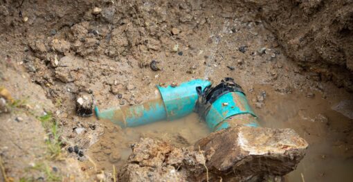
One of the trickiest leaks found was in a tidal flat, where customers were served nearby. The pipe composition was 25-year-old, 12-inch, high density polyethylene (HDPE) crossing the tidal flat and submerged during high tide, but partially exposed during low tide. When this likely leak location was revealed using ASTERRA satellite technology, there were no previous indications of a problem. This portion of pipeline was served by a booster station and an elevated tank near the tidal flat crossing and the upper Floridian Aquifer well.
The BOTG inspection of this tidal flat likely leak location occurred during low tide for optimum ability to view the status unobscured by the flow of water. No acoustic leak detection listening points were available due to the location. The visual inspection showed animal footprints leading to the location. An aerial view of the topography using an Esri field map revealed a blue lagoon. Further inspection showed the surfacing of a potable water leak from the 12-inch main pipe and a hole the size of a golf ball.
Leaks like this can be ongoing for years without detection. In viewing old satellite imagery, the leak could have been viewed as early as 2016, but not as early as 2014. Based on the cost of potable water for this utility and an assumed leak flow rate of 700-1000 GPM, the leak was valued at $500,000 per year as a direct cost and a minimum loss to the utility of $1.5 million dollars.
This coastal service district was proactive in looking for leaks, even before ASTERRA’s solution was evaluated and named effective by a California Energy Commission (CEC) comparative study of available solutions for water leak detection. In the report from the CEC study, ASTERRA was selected as an effective leak detection method that saves energy. The solution was also awarded the American Water Works Association’s inaugural Innovation Award, the Better Satellite World Award, and the many other acknowledgements of its effectiveness.
ASTERRA solutions benefit every terrain and corner of the world. ASTERRA solutions support environmental, social, and governance (ESG) goals and United Nations Sustainable Development Goals 6 (clean water and sanitation), 9 (build resilient infrastructure, promote inclusive and sustainable industrialization, and foster innovation), and 13 (combat climate change and its impacts).
In one marshy region, treated water is no longer wasted by flowing into the ocean, and in all the 64 countries where ASTERRA solutions are used, water is conserved and not wasted.
Municipal water systems across the globe face an invisible crisis that drains billions from public coffers annually. Water losses from...

Water security represents one of the most pressing challenges of the 21st century, with global water demand projected to increase...
Urban infrastructure systems are the backbone of modern society, enabling clean water distribution, waste removal, and the overall health and...