SCROLL FOR MORE INFO
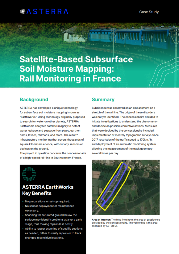
ASTERRA has developed a unique technology for subsurface soil moisture mapping known as “EarthWorks.” Using technology originally purposed to search for water on other planets, ASTERRA Earthworks analyzes satellite imagery to detect water leakage and seepage from pipes, earthen dams, levees, railroads, and more. The result? Infrastructure monitoring that covers thousands of square kilometers at once, without any sensors or devices on the ground.
The project in question concerns the concessionaire of a high-speed rail-line in Southwestern France.
Download