Blogs
SAR Sensor, Remote Sensing, and ASTERRA: Advancing Geospatial Solutions with Synthetic Aperture Radar
November 21, 2022

Synthetic aperture radar (SAR) is an “active” form of data collection, meaning that energy (a radar signal) is emitted from an orbiting sensor down to the Earth, and the SAR sensor then records the “backscatter,” or energy reflected back to an antenna. (The astronauts, or a satellite, snapping pictures would be passive remote sensing.) Once the raw data is received, it’s interpreted for practical application.
Remote sensing is the science of “detecting and monitoring the physical characteristics of an area by measuring its reflected and emitted radiation at a distance,” according to the US Geological Survey.
Its history is older than that definition suggests, going back to the 1840s, when balloon-mounted cameras took images for topographic mapping. An often-cited early example of remote sensing is a series of photographs taken of Paris from a hot air balloon in 1858 by the renowned photographer Gaspard-Félix Tournachon.
After that, remote sensing advanced at the same pace that flight and imaging technology did. Balloons gathered intel during the American Civil War; they were replaced by planes during World War I. High-altitude planes and satellites gave ever-wider views. By the 1960s, astronauts and cosmonauts were snapping pictures from orbit.
Ms. Evelyn Pruitt, a research geographer who studied coastal environments for the U.S. Office of Naval Research, is credited with introducing the term “remote sensing” in the 1950s. Today, remote sensing is part of the life of every human on the planet and of the planet itself. Weather, climate, earth movements, infrastructure, mapping, navigation, wildfires, drought, ocean temperatures, glaciers, and military actions are all observed and studied by some form of remote sensing technology using various wavelengths on the electromagnetic spectrum.
Synthetic aperture radar was invented in 1951 in Goodyear, Ariz., by Carl Wiley. “Synthetic aperture” refers to the fact that a usable resolution would require an impossibly large receiving antenna on the satellite. So, a series of acquisitions from a shorter antenna are combined to simulate or synthesize a longer antenna for fine-resolution images.
Because SAR sensors can produce “fine-resolution images from a limited-resolution system,” it represents a historic breakthrough in remote sensing and Earth observation. Its applications vary widely depending on the wavelength, also known as the band. The wavelength is the distance between two crests of the wave. In the wavelengths typically used for SAR, it’s measured in centimeters.
The “X band,” for instance, with short-spaced crests (3.8 to 2.4 cm), is great for measuring snow and ice in high resolution, but it gets lost in vegetation. C band (7.5 – 3.8 cm) has been called the “workhorse of SAR,” including global mapping and maritime navigation. The longer L band (30-15 cm) is used to penetrate obstacles: cloud cover, vegetation, soil, sand, even asphalt, to a depth of up to 10 feet or more, depending on the composition of the surface.
Remote sensing using SAR is used for everything from mapping ice crevasses in the Antarctic to mapping the lunar surface to monitoring volcanoes. It’s used to study forests, warn of storm surge, spot vegetation loss, and aid in drought prediction. It can also be used to locate leaks of drinkable water or raw sewage from pipe systems below the ground, or the potential failure of infrastructure before actual failure occurs. Being an active sensor, it can be used in any weather, as well as in the day and night.
ASTERRA has developed a series of patented algorithms that can process SAR data to extract information of considerable value to industry, governments, and citizens, specifically, information on soil moisture.
We had earlier mentioned the 30 – 15 cm “L band” of the spectrum, deployed for its ability to penetrate surfaces. By processing the raw SAR data from the L band through one or more of its algorithms, ASTERRA can observe and analyze subsurface soil moisture and determine its characteristics. Because the observation point is orbiting 390 miles above the Earth, it does so with a very wide 217-mile (350 km) view.
This is a groundbreaking achievement. A build-up of soil moisture near a dam or levee can be a sign of imminent collapse. When the soil in hillsides above and below railways or roads becomes permeated with moisture, the hills are more prone to sliding. When a water system is delivering less water than its processing, knowing where the soil is moist can reveal the leaks without breaking ground.
These are the applications for which ASTERRA’s technology is using synthetic aperture radar:
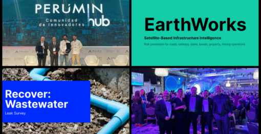
Recover uses SAR sensor data overlaid on a pipe system map to locate underground soil moisture so that leaks can be found and repaired. This can be applied to processed drinking water to reduce water loss and power use, and to wastewater to locate leaks in sewer systems to keep pollution from entering the environment.
MasterPlan processes SAR data to provide an additional layer of refinement to pipe replacement planning models or water system master plans. It uses data gathered over years during multiple satellite passes.
EarthWorks monitors soil moisture near large, risk-prone ground infrastructure to locate areas of concern and potential failure. This provides an opportunity to find and address potentially dangerous situations while there is still time.
EarthWorks monitors soil moisture near:
The operators and managers of these installations can use EarthWorks information to anticipate and prevent catastrophic failure that can lead to loss of lives and property.
ASTERRA will continue to find new ways to use synthetic aperture radar (SAR) data to improve the safety and sustainability of communities worldwide.

Spain is one European country seeing a steady increase in population growth, along with an uptick in urbanization. While scaling...
We are three months into 2024, and the exponential growth ASTERRA experienced in 2023 continues. As the pioneer of sustainable,...

It’s no secret that urban areas are growing, and the migration of more people creates strains on infrastructure and services....